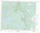
Maps showing Garlic Lake, 24-41-28-W, Manitoba
Garlic Lake is a Lake located in 24-41-28-W, Manitoba and has an elevation of 733 meters.
- Latitude: 52° 32' 33'' North (decimal: 52.5425000)
- Longitude: 101° 21' 10'' West (decimal: -101.3528000)
- Topography Feature Category: Lake
- Geographical Feature: Lake
- Canadian Province/Territory: Manitoba
- Elevation: 733 meters
- Location: 24-41-28-W
- Atlas of Canada Locator Map: Garlic Lake
- GPS Coordinate Locator Map: Garlic Lake Lat/Long