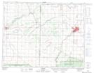
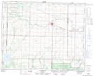
Maps showing Gilbert Plains, Manitoba
Gilbert Plains is a Plain located in Manitoba and has an elevation of 410 meters.
- Latitude: 51° 5' 38'' North (decimal: 51.0939000)
- Longitude: 100° 34' 25'' West (decimal: -100.5735999)
- Topography Feature Category: Plain
- Geographical Feature: Plains
- Canadian Province/Territory: Manitoba
- Elevation: 410 meters
- Atlas of Canada Locator Map: Gilbert Plains
- GPS Coordinate Locator Map: Gilbert Plains Lat/Long
Gilbert Plains NTS Map Sheets