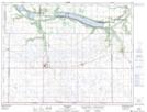
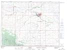
Maps showing Gimby Creek, 5-2-14-W, Manitoba
Gimby Creek is a River located in 5-2-14-W, Manitoba and has an elevation of 456 meters.
- Latitude: 49° 5' 33'' North (decimal: 49.0925000)
- Longitude: 99° 19' 17'' West (decimal: -99.3214000)
- Topography Feature Category: River
- Geographical Feature: Creek
- Canadian Province/Territory: Manitoba
- Elevation: 456 meters
- Location: 5-2-14-W
- Atlas of Canada Locator Map: Gimby Creek
- GPS Coordinate Locator Map: Gimby Creek Lat/Long
Gimby Creek NTS Map Sheets