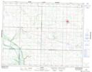
Maps showing Glenlochar, 22-13-26-W, Manitoba
Glenlochar is a Unincorporated area located in 22-13-26-W, Manitoba and has an elevation of 447 meters.
- Latitude: 50° 6' 32'' North (decimal: 50.1088999)
- Longitude: 100° 58' 10'' West (decimal: -100.9693999)
- Topography Feature Category: Unincorporated area
- Geographical Feature: Locality
- Canadian Province/Territory: Manitoba
- Elevation: 447 meters
- Location: 22-13-26-W
- Atlas of Canada Locator Map: Glenlochar
- GPS Coordinate Locator Map: Glenlochar Lat/Long
Glenlochar NTS Map Sheets