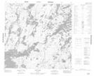
Maps showing Gordon Island, Manitoba
Gordon Island is a Island located in Manitoba.
- Latitude: 59° 5' 23'' North (decimal: 59.0897000)
- Longitude: 99° 46' 54'' West (decimal: -99.7816999)
- Topography Feature Category: Island
- Geographical Feature: Island
- Canadian Province/Territory: Manitoba
- Atlas of Canada Locator Map: Gordon Island
- GPS Coordinate Locator Map: Gordon Island Lat/Long
Gordon Island NTS Map Sheets