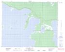
Maps showing Grand Island, 44,45-18-W, Manitoba
Grand Island is a Island located in 44,45-18-W, Manitoba and has an elevation of 274 meters.
- Latitude: 52° 51' 30'' North (decimal: 52.8583000)
- Longitude: 99° 60' 00'' West (decimal: -99.9999999)
- Topography Feature Category: Island
- Geographical Feature: Island
- Canadian Province/Territory: Manitoba
- Elevation: 274 meters
- Location: 44,45-18-W
- Atlas of Canada Locator Map: Grand Island
- GPS Coordinate Locator Map: Grand Island Lat/Long
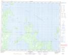
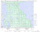
Grand Island NTS Map Sheets