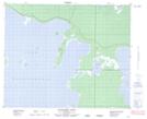
Maps showing Grassy Point, 46-17-W, Manitoba
Grassy Point is a Cape located in 46-17-W, Manitoba.
- Latitude: 52° 57' 48'' North (decimal: 52.9633000)
- Longitude: 99° 54' 17'' West (decimal: -99.9047000)
- Topography Feature Category: Cape
- Geographical Feature: Point
- Canadian Province/Territory: Manitoba
- Location: 46-17-W
- Atlas of Canada Locator Map: Grassy Point
- GPS Coordinate Locator Map: Grassy Point Lat/Long
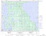
Grassy Point NTS Map Sheets