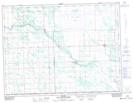
Maps showing Green Ridge, 28-2-4-E, Manitoba
Green Ridge is a Unincorporated area located in 28-2-4-E, Manitoba and has an elevation of 253 meters.
- Latitude: 49° 9' 46'' North (decimal: 49.1627999)
- Longitude: 96° 60' 00'' West (decimal: -96.9999999)
- Topography Feature Category: Unincorporated area
- Geographical Feature: Community
- Canadian Province/Territory: Manitoba
- Elevation: 253 meters
- Location: 28-2-4-E
- Atlas of Canada Locator Map: Green Ridge
- GPS Coordinate Locator Map: Green Ridge Lat/Long