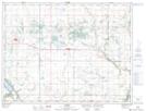
Maps showing Greenway Valley, 4,5-12,13-W, Manitoba
Greenway Valley is a Valley located in 4,5-12,13-W, Manitoba and has an elevation of 427 meters.
- Latitude: 49° 21' 49'' North (decimal: 49.3636000)
- Longitude: 99° 5' 39'' West (decimal: -99.0941999)
- Topography Feature Category: Valley
- Geographical Feature: Valley
- Canadian Province/Territory: Manitoba
- Elevation: 427 meters
- Location: 4,5-12,13-W
- Atlas of Canada Locator Map: Greenway Valley
- GPS Coordinate Locator Map: Greenway Valley Lat/Long