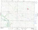
Maps showing Grierson Hill, 2-15-23-W, Manitoba
Grierson Hill is a Mountain located in 2-15-23-W, Manitoba and has an elevation of 540 meters.
- Latitude: 50° 14' 32'' North (decimal: 50.2421999)
- Longitude: 100° 32' 00'' West (decimal: -100.5333000)
- Topography Feature Category: Mountain
- Geographical Feature: Hill
- Canadian Province/Territory: Manitoba
- Elevation: 540 meters
- Location: 2-15-23-W
- Atlas of Canada Locator Map: Grierson Hill
- GPS Coordinate Locator Map: Grierson Hill Lat/Long
Grierson Hill NTS Map Sheets