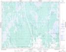
Maps showing Gypsumville Wildlife Management Area, 32,33-8,9-W, Manitoba
Gypsumville Wildlife Management Area is a Conservation area located in 32,33-8,9-W, Manitoba.
- Latitude: 51° 48' 55'' North (decimal: 51.8153000)
- Longitude: 98° 36' 40'' West (decimal: -98.6110999)
- Topography Feature Category: Conservation area
- Geographical Feature: Wildlife Management Area
- Canadian Province/Territory: Manitoba
- Location: 32,33-8,9-W
- Atlas of Canada Locator Map: Gypsumville Wildlife Management Area
- GPS Coordinate Locator Map: Gypsumville Wildlife Management Area Lat/Long
Gypsumville Wildlife Management Area NTS Map Sheets