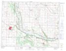
Maps showing Hagerman Slough, 27-10-25-W, Manitoba
Hagerman Slough is a Low vegetation located in 27-10-25-W, Manitoba and has an elevation of 425 meters.
- Latitude: 49° 51' 38'' North (decimal: 49.8606000)
- Longitude: 100° 47' 22'' West (decimal: -100.7894000)
- Topography Feature Category: Low vegetation
- Geographical Feature: Slough
- Canadian Province/Territory: Manitoba
- Elevation: 425 meters
- Location: 27-10-25-W
- Atlas of Canada Locator Map: Hagerman Slough
- GPS Coordinate Locator Map: Hagerman Slough Lat/Long