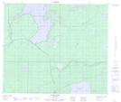
Maps showing Hales Landing, Manitoba
Hales Landing is a Unincorporated area located in Manitoba.
- Latitude: 54° 39' 25'' North (decimal: 54.6568999)
- Longitude: 99° 47' 20'' West (decimal: -99.7889000)
- Topography Feature Category: Unincorporated area
- Geographical Feature: Northern Community
- Canadian Province/Territory: Manitoba
- GPS Coordinate Locator Map: Hales Landing Lat/Long
Hales Landing NTS Map Sheets