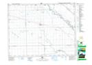
Maps showing Hammercrest Creek, Manitoba
Hammercrest Creek is a River located in Manitoba and has an elevation of 241 meters.
- Latitude: 49° 57' 21'' North (decimal: 49.9558000)
- Longitude: 97° 39' 27'' West (decimal: -97.6575000)
- Topography Feature Category: River
- Geographical Feature: Creek
- Canadian Province/Territory: Manitoba
- Elevation: 241 meters
- Atlas of Canada Locator Map: Hammercrest Creek
- GPS Coordinate Locator Map: Hammercrest Creek Lat/Long