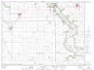
Maps showing Harbor, 8-3-10-W, Manitoba
Harbor is a Unincorporated area located in 8-3-10-W, Manitoba.
- Latitude: 49° 12' North (decimal: 49.1999999)
- Longitude: 98° 47' West (decimal: -98.7833000)
- Topography Feature Category: Unincorporated area
- Geographical Feature: Railway Point
- Canadian Province/Territory: Manitoba
- Location: 8-3-10-W
- GPS Coordinate Locator Map: Harbor Lat/Long
Harbor NTS Map Sheets