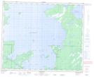
Maps showing Harbour Island, 46-23-W, Manitoba
Harbour Island is a Island located in 46-23-W, Manitoba and has an elevation of 269 meters.
- Latitude: 52° 59' 3'' North (decimal: 52.9841999)
- Longitude: 100° 43' 25'' West (decimal: -100.7236000)
- Topography Feature Category: Island
- Geographical Feature: Island
- Canadian Province/Territory: Manitoba
- Elevation: 269 meters
- Location: 46-23-W
- Atlas of Canada Locator Map: Harbour Island
- GPS Coordinate Locator Map: Harbour Island Lat/Long
Harbour Island NTS Map Sheets