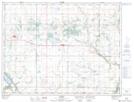
Maps showing Hartney Junction, 6-6-15-W, Manitoba
Hartney Junction is a Unincorporated area located in 6-6-15-W, Manitoba.
- Latitude: 49° 27' 11'' North (decimal: 49.4531000)
- Longitude: 99° 29' 38'' West (decimal: -99.4938999)
- Topography Feature Category: Unincorporated area
- Geographical Feature: Locality
- Canadian Province/Territory: Manitoba
- Location: 6-6-15-W
- Atlas of Canada Locator Map: Hartney Junction
- GPS Coordinate Locator Map: Hartney Junction Lat/Long