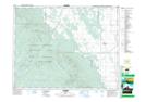
Maps showing Henderson Creek, 22-15-W, Manitoba
Henderson Creek is a River located in 22-15-W, Manitoba and has an elevation of 279 meters.
- Latitude: 50° 55' 50'' North (decimal: 50.9306000)
- Longitude: 99° 31' 41'' West (decimal: -99.5281000)
- Topography Feature Category: River
- Geographical Feature: Creek
- Canadian Province/Territory: Manitoba
- Elevation: 279 meters
- Location: 22-15-W
- Atlas of Canada Locator Map: Henderson Creek
- GPS Coordinate Locator Map: Henderson Creek Lat/Long