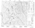
Maps showing Herchmer, Manitoba
Herchmer is a Unincorporated area located in Manitoba and has an elevation of 102 meters.
- Latitude: 57° 22' 13'' North (decimal: 57.3702999)
- Longitude: 94° 10' 10'' West (decimal: -94.1694000)
- Topography Feature Category: Unincorporated area
- Geographical Feature: Community
- Canadian Province/Territory: Manitoba
- Elevation: 102 meters
- Atlas of Canada Locator Map: Herchmer
- GPS Coordinate Locator Map: Herchmer Lat/Long