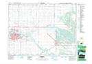
Maps showing Highland Park, Manitoba
Highland Park is a Unincorporated area located in Manitoba and has an elevation of 389 meters.
- Latitude: 49° 52' 44'' North (decimal: 49.8789000)
- Longitude: 99° 56' 59'' West (decimal: -99.9496999)
- Topography Feature Category: Unincorporated area
- Geographical Feature: Neighbourhood
- Canadian Province/Territory: Manitoba
- Elevation: 389 meters
- Atlas of Canada Locator Map: Highland Park
- GPS Coordinate Locator Map: Highland Park Lat/Long