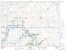
Maps showing Hirst Hill, 5,6-6-9-W, Manitoba
Hirst Hill is a Mountain located in 5,6-6-9-W, Manitoba and has an elevation of 487 meters.
- Latitude: 49° 26' 59'' North (decimal: 49.4497000)
- Longitude: 98° 39' 19'' West (decimal: -98.6553000)
- Topography Feature Category: Mountain
- Geographical Feature: Hill
- Canadian Province/Territory: Manitoba
- Elevation: 487 meters
- Location: 5,6-6-9-W
- Atlas of Canada Locator Map: Hirst Hill
- GPS Coordinate Locator Map: Hirst Hill Lat/Long