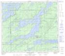
Maps showing Hockin, 34-72-3-W, Manitoba
Hockin is a Unincorporated area located in 34-72-3-W, Manitoba and has an elevation of 187 meters.
- Latitude: 55° 16' 35'' North (decimal: 55.2763999)
- Longitude: 97° 49' 50'' West (decimal: -97.8306000)
- Topography Feature Category: Unincorporated area
- Geographical Feature: Railway Point
- Canadian Province/Territory: Manitoba
- Elevation: 187 meters
- Location: 34-72-3-W
- Atlas of Canada Locator Map: Hockin
- GPS Coordinate Locator Map: Hockin Lat/Long
Hockin NTS Map Sheets