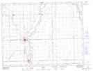
Maps showing Horseshoe Lake, 4-1,2-E, Manitoba
Horseshoe Lake is a Lake located in 4-1,2-E, Manitoba and has an elevation of 238 meters.
- Latitude: 49° 20' 19'' North (decimal: 49.3386000)
- Longitude: 97° 19' 24'' West (decimal: -97.3232999)
- Topography Feature Category: Lake
- Geographical Feature: Lake
- Canadian Province/Territory: Manitoba
- Elevation: 238 meters
- Location: 4-1,2-E
- Atlas of Canada Locator Map: Horseshoe Lake
- GPS Coordinate Locator Map: Horseshoe Lake Lat/Long