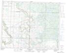
Maps showing Horseshoe Meadow, 24-27-27-W, Manitoba
Horseshoe Meadow is a Low vegetation located in 24-27-27-W, Manitoba.
- Latitude: 51° 19' 47'' North (decimal: 51.3296999)
- Longitude: 101° 8' 2'' West (decimal: -101.1338999)
- Topography Feature Category: Low vegetation
- Geographical Feature: Meadow
- Canadian Province/Territory: Manitoba
- Location: 24-27-27-W
- Atlas of Canada Locator Map: Horseshoe Meadow
- GPS Coordinate Locator Map: Horseshoe Meadow Lat/Long
Horseshoe Meadow NTS Map Sheets