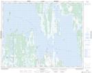
Maps showing Hunter Island, Manitoba
Hunter Island is a Island located in Manitoba.
- Latitude: 51° 33' 16'' North (decimal: 51.5544000)
- Longitude: 99° 16' 41'' West (decimal: -99.2781000)
- Topography Feature Category: Island
- Geographical Feature: Island
- Canadian Province/Territory: Manitoba
- GPS Coordinate Locator Map: Hunter Island Lat/Long
Hunter Island NTS Map Sheets