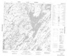
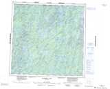
Maps showing Husky Portage, Manitoba
Husky Portage is a Road feature located in Manitoba and has an elevation of 330 meters.
- Latitude: 59° 50' 37'' North (decimal: 59.8435999)
- Longitude: 100° 43' 51'' West (decimal: -100.7307999)
- Topography Feature Category: Road feature
- Geographical Feature: Portage
- Canadian Province/Territory: Manitoba
- Elevation: 330 meters
- Atlas of Canada Locator Map: Husky Portage
- GPS Coordinate Locator Map: Husky Portage Lat/Long
Husky Portage NTS Map Sheets