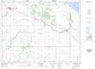
Maps showing Image Plain, 12-9-W, Manitoba
Image Plain is a Plain located in 12-9-W, Manitoba.
- Latitude: 50° 2' North (decimal: 50.0333000)
- Longitude: 98° 33' West (decimal: -98.5500000)
- Topography Feature Category: Plain
- Geographical Feature: Plain
- Canadian Province/Territory: Manitoba
- Location: 12-9-W
- GPS Coordinate Locator Map: Image Plain Lat/Long