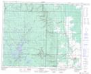
Maps showing Indian Creek, 11-33-24-W, Manitoba
Indian Creek is a River located in 11-33-24-W, Manitoba and has an elevation of 726 meters.
- Latitude: 51° 49' 27'' North (decimal: 51.8241999)
- Longitude: 100° 45' 8'' West (decimal: -100.7521999)
- Topography Feature Category: River
- Geographical Feature: Creek
- Canadian Province/Territory: Manitoba
- Elevation: 726 meters
- Location: 11-33-24-W
- Atlas of Canada Locator Map: Indian Creek
- GPS Coordinate Locator Map: Indian Creek Lat/Long
Indian Creek NTS Map Sheets