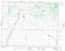
Maps showing Indian Lake, 17,18-20-25-W, Manitoba
Indian Lake is a Lake located in 17,18-20-25-W, Manitoba and has an elevation of 560 meters.
- Latitude: 50° 43' 31'' North (decimal: 50.7252999)
- Longitude: 100° 55' 53'' West (decimal: -100.9314000)
- Topography Feature Category: Lake
- Geographical Feature: Lake
- Canadian Province/Territory: Manitoba
- Elevation: 560 meters
- Location: 17,18-20-25-W
- Atlas of Canada Locator Map: Indian Lake
- GPS Coordinate Locator Map: Indian Lake Lat/Long
Indian Lake NTS Map Sheets