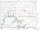
Maps showing Indian Springs, 17-5-11-W, Manitoba
Indian Springs is a Unincorporated area located in 17-5-11-W, Manitoba and has an elevation of 449 meters.
- Latitude: 49° 23' 21'' North (decimal: 49.3892000)
- Longitude: 98° 54' 32'' West (decimal: -98.9089000)
- Topography Feature Category: Unincorporated area
- Geographical Feature: Locality
- Canadian Province/Territory: Manitoba
- Elevation: 449 meters
- Location: 17-5-11-W
- Atlas of Canada Locator Map: Indian Springs
- GPS Coordinate Locator Map: Indian Springs Lat/Long