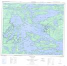
Maps showing Réserve indienne Island Lake 22, Manitoba
Réserve indienne Island Lake 22 is a Indian Reserve located in Manitoba.
- Latitude: 53° 48' 45'' North (decimal: 53.8125000)
- Longitude: 94° 55' 5'' West (decimal: -94.9180999)
- Topography Feature Category: Indian Reserve
- Geographical Feature: Réserve indienne
- Canadian Province/Territory: Manitoba
- GPS Coordinate Locator Map: Réserve indienne Island Lake 22 Lat/Long
Réserve indienne Island Lake 22 NTS Map Sheets