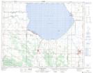
Maps showing Jackfish Creek, 4-25-18-W, Manitoba
Jackfish Creek is a River located in 4-25-18-W, Manitoba and has an elevation of 283 meters.
- Latitude: 51° 8' 2'' North (decimal: 51.1338999)
- Longitude: 99° 55' 59'' West (decimal: -99.9331000)
- Topography Feature Category: River
- Geographical Feature: Creek
- Canadian Province/Territory: Manitoba
- Elevation: 283 meters
- Location: 4-25-18-W
- Atlas of Canada Locator Map: Jackfish Creek
- GPS Coordinate Locator Map: Jackfish Creek Lat/Long
Jackfish Creek NTS Map Sheets