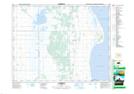
Maps showing Jackfish Lake, 16,17-10,11-W, Manitoba
Jackfish Lake is a Lake located in 16,17-10,11-W, Manitoba.
- Latitude: 50° 27' 45'' North (decimal: 50.4624999)
- Longitude: 98° 51' 35'' West (decimal: -98.8597000)
- Topography Feature Category: Lake
- Geographical Feature: Lake
- Canadian Province/Territory: Manitoba
- Location: 16,17-10,11-W
- Atlas of Canada Locator Map: Jackfish Lake
- GPS Coordinate Locator Map: Jackfish Lake Lat/Long
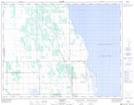
Jackfish Lake NTS Map Sheets