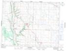
Maps showing Jollyes Lake, 9,10-20-28-W, Manitoba
Jollyes Lake is a Lake located in 9,10-20-28-W, Manitoba.
- Latitude: 50° 42' 15'' North (decimal: 50.7041999)
- Longitude: 101° 17' 46'' West (decimal: -101.2960999)
- Topography Feature Category: Lake
- Geographical Feature: Lake
- Canadian Province/Territory: Manitoba
- Location: 9,10-20-28-W
- Atlas of Canada Locator Map: Jollyes Lake
- GPS Coordinate Locator Map: Jollyes Lake Lat/Long
Jollyes Lake NTS Map Sheets