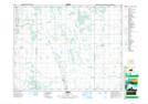
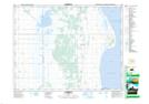
Maps showing Jumping Deer Creek, 11-17-11-W, Manitoba
Jumping Deer Creek is a River located in 11-17-11-W, Manitoba.
- Latitude: 50° 25' 58'' North (decimal: 50.4327999)
- Longitude: 98° 54' 00'' West (decimal: -98.8999999)
- Topography Feature Category: River
- Geographical Feature: Creek
- Canadian Province/Territory: Manitoba
- Location: 11-17-11-W
- Atlas of Canada Locator Map: Jumping Deer Creek
- GPS Coordinate Locator Map: Jumping Deer Creek Lat/Long
Jumping Deer Creek NTS Map Sheets