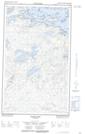
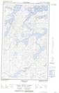
Maps showing Kakakiunank Lake, Manitoba
Kakakiunank Lake is a Lake located in Manitoba.
- Latitude: 53° 37' 20'' North (decimal: 53.6222000)
- Longitude: 94° 52' 29'' West (decimal: -94.8747000)
- Topography Feature Category: Lake
- Geographical Feature: Lake
- Canadian Province/Territory: Manitoba
- Atlas of Canada Locator Map: Kakakiunank Lake
- GPS Coordinate Locator Map: Kakakiunank Lake Lat/Long
Kakakiunank Lake NTS Map Sheets