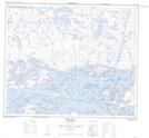
Maps showing Kamekanskwatinak Hill, Manitoba
Kamekanskwatinak Hill is a Mountain located in Manitoba.
- Latitude: 53° 56' 19'' North (decimal: 53.9385999)
- Longitude: 94° 2' 10'' West (decimal: -94.0360999)
- Topography Feature Category: Mountain
- Geographical Feature: Hill
- Canadian Province/Territory: Manitoba
- Atlas of Canada Locator Map: Kamekanskwatinak Hill
- GPS Coordinate Locator Map: Kamekanskwatinak Hill Lat/Long
Kamekanskwatinak Hill NTS Map Sheets