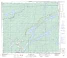
Maps showing Kanutiministikwapisk Bay, 7,18-79-1-W, Manitoba
Kanutiministikwapisk Bay is a Bay located in 7,18-79-1-W, Manitoba and has an elevation of 186 meters.
- Latitude: 55° 50' 7'' North (decimal: 55.8352999)
- Longitude: 97° 35' 53'' West (decimal: -97.5980999)
- Topography Feature Category: Bay
- Geographical Feature: Bay
- Canadian Province/Territory: Manitoba
- Elevation: 186 meters
- Location: 7,18-79-1-W
- Atlas of Canada Locator Map: Kanutiministikwapisk Bay
- GPS Coordinate Locator Map: Kanutiministikwapisk Bay Lat/Long
Kanutiministikwapisk Bay NTS Map Sheets