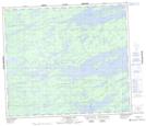
Maps showing Kapayakwaskisoot River, 70-10-E, Manitoba
Kapayakwaskisoot River is a River located in 70-10-E, Manitoba and has an elevation of 211 meters.
- Latitude: 55° 4' 44'' North (decimal: 55.0789000)
- Longitude: 96° 5' 13'' West (decimal: -96.0869000)
- Topography Feature Category: River
- Geographical Feature: River
- Canadian Province/Territory: Manitoba
- Elevation: 211 meters
- Location: 70-10-E
- Atlas of Canada Locator Map: Kapayakwaskisoot River
- GPS Coordinate Locator Map: Kapayakwaskisoot River Lat/Long
Kapayakwaskisoot River NTS Map Sheets