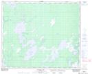
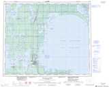
Maps showing Kawisapiskeetak Lake, 23,26-52-15-W, Manitoba
Kawisapiskeetak Lake is a Lake located in 23,26-52-15-W, Manitoba and has an elevation of 273 meters.
- Latitude: 53° 30' 59'' North (decimal: 53.5163999)
- Longitude: 99° 33' 41'' West (decimal: -99.5613999)
- Topography Feature Category: Lake
- Geographical Feature: Lake
- Canadian Province/Territory: Manitoba
- Elevation: 273 meters
- Location: 23,26-52-15-W
- Atlas of Canada Locator Map: Kawisapiskeetak Lake
- GPS Coordinate Locator Map: Kawisapiskeetak Lake Lat/Long
Kawisapiskeetak Lake NTS Map Sheets