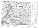
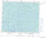
Maps showing Kechimenis Island, Manitoba
Kechimenis Island is a Island located in Manitoba and has an elevation of 290 meters.
- Latitude: 52° 1' 37'' North (decimal: 52.0268999)
- Longitude: 95° 29' 58'' West (decimal: -95.4994000)
- Topography Feature Category: Island
- Geographical Feature: Island
- Canadian Province/Territory: Manitoba
- Elevation: 290 meters
- Atlas of Canada Locator Map: Kechimenis Island
- GPS Coordinate Locator Map: Kechimenis Island Lat/Long
Kechimenis Island NTS Map Sheets