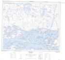
Maps showing Keespakotik Island, Manitoba
Keespakotik Island is a Island located in Manitoba.
- Latitude: 53° 47' 42'' North (decimal: 53.7950000)
- Longitude: 94° 26' 10'' West (decimal: -94.4361000)
- Topography Feature Category: Island
- Geographical Feature: Island
- Canadian Province/Territory: Manitoba
- Atlas of Canada Locator Map: Keespakotik Island
- GPS Coordinate Locator Map: Keespakotik Island Lat/Long
Keespakotik Island NTS Map Sheets