Maps showing Kelloe, 3-17-24-W, Manitoba
Kelloe is a Unincorporated area located in 3-17-24-W, Manitoba and has an elevation of 553 meters.
- Latitude: 50° 28' 37'' North (decimal: 50.4768999)
- Longitude: 100° 45' 58'' West (decimal: -100.7661000)
- Topography Feature Category: Unincorporated area
- Geographical Feature: Community
- Canadian Province/Territory: Manitoba
- Elevation: 553 meters
- Location: 3-17-24-W
- Atlas of Canada Locator Map: Kelloe
- GPS Coordinate Locator Map: Kelloe Lat/Long
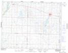
Kelloe NTS Map Sheets