Maps showing Kelly Island Lake, 30-27-26-W, Manitoba
Kelly Island Lake is a Lake located in 30-27-26-W, Manitoba and has an elevation of 632 meters.
- Latitude: 51° 20' 38'' North (decimal: 51.3439000)
- Longitude: 101° 5' 54'' West (decimal: -101.0983000)
- Topography Feature Category: Lake
- Geographical Feature: Lake
- Canadian Province/Territory: Manitoba
- Elevation: 632 meters
- Location: 30-27-26-W
- Atlas of Canada Locator Map: Kelly Island Lake
- GPS Coordinate Locator Map: Kelly Island Lake Lat/Long
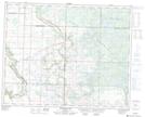
Kelly Island Lake NTS Map Sheets