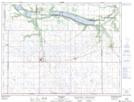
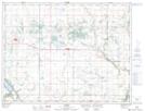
Maps showing Kellys Ravine, 3-14-W, Manitoba
Kellys Ravine is a Valley located in 3-14-W, Manitoba and has an elevation of 428 meters.
- Latitude: 49° 14' 59'' North (decimal: 49.2497000)
- Longitude: 99° 16' 59'' West (decimal: -99.2831000)
- Topography Feature Category: Valley
- Geographical Feature: Ravine
- Canadian Province/Territory: Manitoba
- Elevation: 428 meters
- Location: 3-14-W
- Atlas of Canada Locator Map: Kellys Ravine
- GPS Coordinate Locator Map: Kellys Ravine Lat/Long
Kellys Ravine NTS Map Sheets