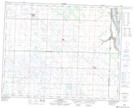
Maps showing Kennedy Hill, 18-25-29-W, Manitoba
Kennedy Hill is a Mountain located in 18-25-29-W, Manitoba and has an elevation of 470 meters.
- Latitude: 51° 9' 30'' North (decimal: 51.1583000)
- Longitude: 101° 31' 11'' West (decimal: -101.5197000)
- Topography Feature Category: Mountain
- Geographical Feature: Hill
- Canadian Province/Territory: Manitoba
- Elevation: 470 meters
- Location: 18-25-29-W
- Atlas of Canada Locator Map: Kennedy Hill
- GPS Coordinate Locator Map: Kennedy Hill Lat/Long
Kennedy Hill NTS Map Sheets