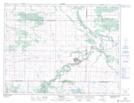
Maps showing Kent Lake, 4,9-7-18-W, Manitoba
Kent Lake is a Lake located in 4,9-7-18-W, Manitoba and has an elevation of 435 meters.
- Latitude: 49° 32' 56'' North (decimal: 49.5488999)
- Longitude: 99° 51' 27'' West (decimal: -99.8575000)
- Topography Feature Category: Lake
- Geographical Feature: Lake
- Canadian Province/Territory: Manitoba
- Elevation: 435 meters
- Location: 4,9-7-18-W
- Atlas of Canada Locator Map: Kent Lake
- GPS Coordinate Locator Map: Kent Lake Lat/Long