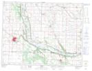
Maps showing Kenton Reservoir, 6-12-23-W, Manitoba
Kenton Reservoir is a Lake located in 6-12-23-W, Manitoba and has an elevation of 437 meters.
- Latitude: 49° 58' 47'' North (decimal: 49.9796999)
- Longitude: 100° 36' 36'' West (decimal: -100.6100000)
- Topography Feature Category: Lake
- Geographical Feature: Reservoir
- Canadian Province/Territory: Manitoba
- Elevation: 437 meters
- Location: 6-12-23-W
- Atlas of Canada Locator Map: Kenton Reservoir
- GPS Coordinate Locator Map: Kenton Reservoir Lat/Long