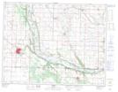
Maps showing Kenworth Dam, 6-12-23-W, Manitoba
Kenworth Dam is a Hydraulic construction located in 6-12-23-W, Manitoba.
- Latitude: 49° 58' 45'' North (decimal: 49.9792000)
- Longitude: 100° 36' 24'' West (decimal: -100.6066999)
- Topography Feature Category: Hydraulic construction
- Geographical Feature: Dam
- Canadian Province/Territory: Manitoba
- Location: 6-12-23-W
- Atlas of Canada Locator Map: Kenworth Dam
- GPS Coordinate Locator Map: Kenworth Dam Lat/Long