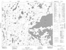
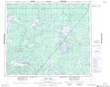
Maps showing Kerry Lake, Manitoba
Kerry Lake is a Lake located in Manitoba and has an elevation of 194 meters.
- Latitude: 54° 41' 26'' North (decimal: 54.6906000)
- Longitude: 92° 47' 56'' West (decimal: -92.7988999)
- Topography Feature Category: Lake
- Geographical Feature: Lake
- Canadian Province/Territory: Manitoba
- Elevation: 194 meters
- Atlas of Canada Locator Map: Kerry Lake
- GPS Coordinate Locator Map: Kerry Lake Lat/Long
Kerry Lake NTS Map Sheets